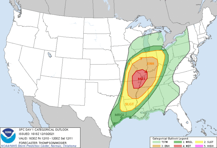
The storms are brewing! Storm Prediction Center upgraded the outlook to a Moderate Risk.
For those who may not know, a moderate risk is a little more intense than an enhanced risk. By looking at the graphic above from the Storm Prediction Center, the red is currently the hot spot for stronger storms and tornadoes.
Although the focus is typically on Middle Tennessee with a current enhanced risk, it is always good to be aware if you are traveling for the weekend or know of someone who may live in these areas.
Please remain aware throughout the day and if you have access to a weather radio or notifications on your phone, keep them on as these storms will be occurring later into the evening.
See our live weather radar here.
Up to the minute, updates and weather watches and warnings powered by ReadyWarn can also be found on our local Source Facebook page and Twitter. Or have our daily e-mail with weather and more delivered to your e-mail box each morning and afternoon by signing up on your county homepage.
Find your Close to Home(SM) news, weather, events and more by using our interactive map.
Subscribe to our FREE Newsletter


